The Chaqueño Park of Santiago del Estero: historical review of its use and future bioeconomic perspectives
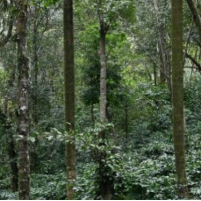
Initially, we should define what we call native forests. According to the definition proposed in the National Law 26,331 on Minimum Budgets for the Protection of Native Forests, they are called: natural forest ecosystems composed predominantly of mature native tree species, with various species of associated flora and fauna, together with the environment that surrounds them (soil, subsoil, atmosphere, climate, water resources), forming an interdependent plot with its own characteristics and multiple functions, which in its natural state give the system a condition of balance. dinámico y que brinda diversos servicios ambientales a la sociedad, además de los diversos recursos naturales con posibilidad de utilización económica. It also includes those of secondary origin formed after clearing, as well as those resulting from voluntary recomposition or restoration.
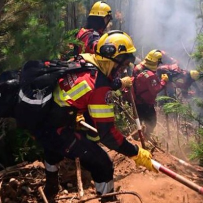
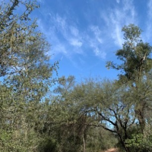
The province of Santiago del Estero is represented almost entirely by the Chaco Dry ecoregion, which is characterized by presenting a continuous mosaic of vegetation where three types of physiognomies are combined: forest, savannas and grasslands. Various plant species are well adapted to extreme climatic conditions such as high temperatures in the summer, areas with high concentration of salts in the soil and conditions of water deficit in most of the year. These adaptations to the environment make this ecosystem an interesting space in the understanding of its physiological and ecological characters. Given the interrelationships between vegetation, fauna, society, climate and ecosystem services, they need to be understood and attended to in order to perpetuate sustainable use for future generations. However, since the end of the 19th century, the exploitation of forest resources in the region, and then the change in land use since the 1990s, were practices that undid the original landscape, leaving vestiges of forest, which some today are are under protection laws, others susceptible to being transformed and others to a large extent degraded. With the agricultural expansion of the 90s, driven by technological packages and pampeanization, the pressure on forests deepened, displacing communities, degrading soils and eroding cultural identities. This process highlighted the need to move from an extractive paradigm to a bioeconomic one, which values ??both ecosystem services and historical territorial practices. Interest in tannin, sleepers and coal At the beginning of the 20th century, an economic revolution was brewing in Argentina that accompanied global demands in close relationship with European countries. British capital was installed promoting economic development at the expense of the excessive extraction and exploitation of natural resources. Motivated by obtaining tannin, the English company La Forestal settled in 1906 in the Chaco region to obtain the greatest number of individuals of the Chaco red quebracho (Schinopsis balansae) and later the Santiago red quebracho (Schinopsis lorentzii). This extraction was defined by authors from both the social and forestry sciences, as of a mining nature, where once the individuals with the best size, stem height and health status were obtained, the soil was abandoned and the workshops had to move towards new portions of forest. At that time, almost 11,000,000 hectares of forest land of the best quebrachales were exploited, giving birth to an incipient forestry industry that had its boom in the first half of the 20th century. By 1920, the forests of the north and east of Santiago del Estero supplied raw material for the production of sleepers, in addition to obtaining tannin and charcoal, generating 227,320 tons of forest products. In parallel, towards the center of the province, mountain livestock farming was a method taught among the farmers of the time. Los serviles, descendientes de comunidades indígenas aplicaban esta práctica sobre el monte abierto y las sabanas, que se regía de acuerdo a la disponibilidad de pastos en momentos posteriores a la estación húmeda en las regiones de desborde de los ríos Dulce y Salado.Hacia el sur-oeste, bosques más bajos y abiertos dieron lugar a la obtención de leña, carbón, postes de diversos tamaños y otros usos no maderables como la obtención de goma brea.A lo largo del tiempo, el aprovechamiento de especies forestales Systematicity was generated, which began with the extraction of poles, then wood for the sawmill and finally the species of lesser forest importance for firewood and charcoal. By the 1950s, the province had gone from containing a stock of 11,000,000 hectares of forest at the beginning of the century, to only 6,000,000 hectares. This system extended throughout the 20th century until the mid-90s when the commodity market was positioned as the main method of sales of raw materials. In the Chaco Region, and particularly in Santiago del Estero, a process of abrupt change in land use arose, given its capacity to house soybean and corn crops, as well as megathermal pastures. These characteristics allowed the rapid expansion of the agricultural frontier, imitating those landscapes typical of the Pampas region, a phenomenon known as pampeanization. The abrupt change in land use not only implied the elimination of natural resources, but also led to a loss of cultural, historical and identity values of the native inhabitants, thus causing the expulsion from their territory, the dispossession of their productive systems, and their forms of community life. Environmental protection and territorial planning lawAs you can See, much of the advance of the agricultural frontier in the Argentine Dry Chaco did not occur on depopulated lands, but on lands traditionally used by indigenous and peasant communities, whose land tenure, for the most part, is not formal. In this context, the Law on Minimum Budgets for Environmental Protection of Native Forests was passed in 2007, with the aim of avoiding deforestation or changes in deregulated land use. The law is materialized through a management instrument called Territorial Planning of Native Forests (OTBN), where each province is obliged to classify its native forests according to three conservation categories: red, yellow and green. Each category specifies the activities that can be carried out in areas with forests. The red category is the one with the greatest restriction and which, due to its high conservation value, does not allow clearing. The yellow category contains forests of medium conservation value that do not enable clearing but allow sustainable and restricted use, and finally, the green category, which identifies forests of low conservation value suitable for land use change. A prevailing issue is the power that the provinces have to manage the conservation and use of forests. This must be done taking into account that the national law defines minimum budgets above which the provinces must maintain or exceed them depending on the state of the forest in each of them. By 2008, according to the first territorial order, Santiago del Estero had 7,600,000 hectares of native forest. By 2015, the hectares of native forest in Santiago del Estero amounted to 7,718,000. In percentages, almost 80% are classified in the yellow category, followed by 12% in the red category and 7.5% in green. In these figures you can see how the registration and monitoring of forests allows evaluating the preservation and recovery of forests. It is worth clarifying that the deadline for the third update of the OTBN of Santiago del Estero expired in 2020, so the official data used by technicians and researchers refer to the year 2015. Another point in the review and improvement of the OTBN of 2015 for the execution of plans of the Law is based on the fact that, for the second update, the figure of grouped beneficiaries is added with the purpose of incorporating, although partially, peasant groups and indigenous communities given the situation of land ownership as a limitation. An important situation to comment on is the constant appearance of illegal clearings between the periods 2008-2014, whose comprehensive effect on the law remains scarce. In fact, the law does not provide for sanction mechanisms and in Santiago del Estero, sanctions for clearing are graduated according to provincial law 6841. According to data published by RedAf obtained in 2021, until 2014 the number of illegal clearings far exceeded the number of permitted clearings, with the first being 610,787 hectares illegally cleared among the three categories, while the Authorized clearings for the green and yellow category were a total of 143,791 ha. Another report obtained from the National Directorate of Forests for the year 2023, indicated that Santiago del Estero was the second province in the Chaqueño Park and the third at the national level to present the greatest loss of native forest. This data does not discriminate between types of clearing or other disturbances, but rather reflects a global figure for each province. As of the date of writing this study, it is the report with the most recent data. In relation to the above, in the year 2023 in Santiago del Estero, 38,771 hectares of forest cover loss were recorded in the yellow category, followed by 635 hectares in the green category and 282 in the red category, with the highest proportion of these located in the Pellegrini, Alberdi and Juan Felipe Ibarra departments. This suggests that the greatest proportion of change in yellow could be due to silvopastoral practices with practically total removal of forest; agricultural uses, and fires. Although, since the passing of the law in 2007, there has been a downward trend in the loss of native forests in the Chaco region, this is still a region where there are possible threats of increasing the change in cover. In 2021, a report prepared by technicians from the Chaco Argentina Agroforestry Network (RedAf), pointed out the weaknesses in the access of peasant communities to the conservation fund for the execution of plans within the framework of the Law, in Santiago del Estero, focusing on the situation of precarious land tenure. Another key point in the 2015 OTBN update is the incorporation of biological corridors, since it allows not only the comprehensive approach to landscape conservation, but also evaluate the connectivity between environments.