SISINTA: The digital map that transforms the knowledge of soils into a key tool for production
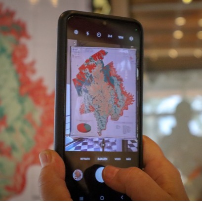
The Inta Soil Institute launched the Soil Information System (SISINTA), a platform that integrates more than 7,000 georeferenced soil profiles from all regions of the country. This digital, free and free access tool allows producers, technicians and decision makers to access precise and updated information on the characteristics and aptitudes of the soil in each territory.
Sisinta (www.visor.inta.gob.ar) combines field and laboratory data with geographical location, allowing searches to be performed by zone or specific attributes. Information can be organized in series or projects, downloading in different formats and being used in analysis software such as calculation forms, statistical tools or geographic information systems (GIS) .In the case of missions, the floor letters of the Guaraní and Leandro N. Alem departments were recently incorporated, with key information for productive planning. In Guaraní, more than 327,000 hectares were relieved, in a project that demanded two years of work and the participation of 30 professionals. Lucas Moretti, Doctor of Geological Sciences and project coordinator by INTA, he explained that this semi -talled cartography allows to calculate the productivity index of each plot depending on different crops. It is a great tool that the producer can access this resource digitally farm and see both the characteristic soils of their location as well as the recommendations for its management, to make decisions based on knowledge, he said. The Guaraní Department, in particular, presents geographical challenges due to its soils in mountain range and pronounced slopes. Thanks to digital maps, it is now possible to identify the different degrees of soil aptitude and their productive potentials with greater precision. With this tool, the INTA is committed to democratizing access to knowledge about Argentine soils, promoting a more efficient, sustainable and adapted agriculture adapted to the particularities of each territory.
IT MAY INTEREST YOU
 The forest of the oldest shadows: the story of the petrified trees
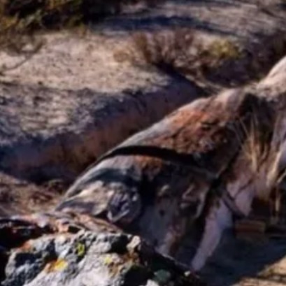
One of the natural treasures of Río Negro turns 23 years old under the protection law that allows its conservation. Where it is and how it was formed. Río Negro celebrates 23 years of conservation in the petrified forest as a Protected Natural Area (ANP). It is a space of 625 hectares that protects an exceptional site of fossil trunks that date back more than 60 million years.
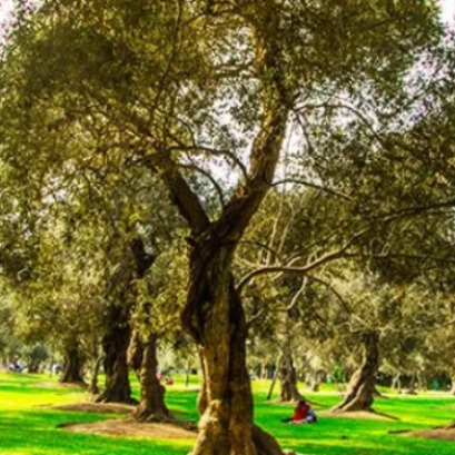 The city in South America that breathes thanks to a thousand olive trees planted in the 17th century
In the heart of South America there is a city that, among the noise and concrete, still breathes thanks to an olive forest
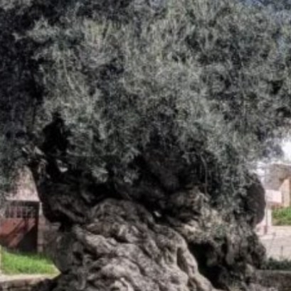 Experts cant believe it, but this tree is the oldest in the world and continues to bear fruit: it is 4,000 years old.
Nature keeps secrets that defy the passage of time, and one of the most surprising examples is a tree that, approximately 4,000 years old, continues to bear fruit today. This specimen has become a symbol of resistance and longevity, capable of surviving climate changes, landscape transformations and human activity itself.