INTA ForestMap: from drone data to forest management
INTA researchers developed INTA ForestMap, an application that processes photogrammetric and LiDAR surveys through a graphical interface. The development was led by Eduardo Hildt, a researcher in the Forestry group at INTA Montecarlo, together with Abel Scherf, from the same Experimental, and Martín Galarza, from INTA Yuto, Jujuy. It is an application that allows you to transform surveys carried out with drones into information on the number and height of trees, canopy coverage and terrain characteristics. It is a free and open source tool, aimed at professionals who already work with photogrammetry and generate 3D point clouds.
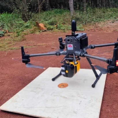
Drones make it possible to survey forest plantations in a short time and with a high level of detail. However, between obtaining this data and converting it into useful information for management, there is a difficulty: its processing usually requires specialized programs, expensive licenses or programming knowledge. To reduce this gap, INTA researchers developed INTA ForestMap, an application that processes photogrammetric and LiDAR surveys through a graphical interface. The development was led by Eduardo Hildt, a researcher in the Forestry group at INTA Montecarlo, together with Abel Scherf, from the same Experimental, and Martín Galarza, from INTA Yuto, Jujuy. For professionals who already work with drones The application is not designed for those who are new to using drones, but for professionals who already work with this technology: “The tool is designed for professionals who already make advanced use of drones and who want to process the 3D point clouds that they already have. "They are generating with their photogrammetry processes and currently they cannot be transformed into information of forest interest," explained Hildt, INTA Monte Carlos reference in these technologies and one of those responsible for the development. Aerial surveys can generate three-dimensional point clouds that represent the relief and structure of the vegetation. From them it is possible to obtain key information on variables such as height and distribution of trees, canopy coverage and terrain characteristics. There are commercial programs to process this data, but they may involve high-cost licenses. There are also free tools, although many require programming knowledge or combining different programs. ForestMap seeks to simplify this process by bringing together the different stages of the analysis in the same environment. The application classifies the points corresponding to the terrain and vegetation, generates digital models of elevation and crown height, identifies individual trees and calculates tree cover. It also produces contour lines and indicators on the stand structure. ForestMap incorporates configurations for flat, undulating and broken terrain and allows parameters to be adjusted according to the characteristics of the site. Upon completion, the results can be exported for use in Geographic Information Systems (GIS) and the application automatically generates a PDF report. The tool is open source and free to download, so it does not require the payment of licenses. A test in Misiones To demonstrate its operation, the researchers used information obtained through photogrammetry with a drone in a silvopastoral system located in Santiago de Liniers, Misiones. The area included six stands totaling 27.7 hectares: five of Pinus and one of Eucalyptus. The processing allowed a total of 4,362 trees to be identified. The densities of the plots varied between 116 and 196 trees per hectare, the average heights between 14.5 and 22 meters and the canopy coverage between 19.7% and 58.2%. The percentage of crown coverage is a key piece of information, since it describes the level of competition for light between the trees and the pasture that must feed the livestock. The tool also detected particularities within the plots. In a pine stand, a marked variation in height was recorded associated with the presence of a eucalyptus block. In the pure eucalyptus stand, crown cover was 19.7 percent, considerably lower than in the pine forests due to the design of the plantation in double lines separated by wide alleys. A tool for management The contribution of ForestMap is not in the flight of the drone or in the data capture, but in the subsequent step: transforming the 3D point clouds generated by photogrammetry or LiDAR into variables of forest interest. In this sense, the application is aimed at specialized users and seeks to allow them to get more out of the information they are already generating. By automating a good part of the processing, ForestMap aims to reduce one of the barriers that make it difficult to take advantage of these surveys: going from a large amount of three-dimensional data to concrete information about the structure of a plantation. Development remains open to the incorporation of new algorithms that expand its analysis capabilities.